Back to
randonnee
Back to
randonnee
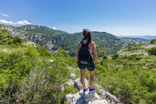
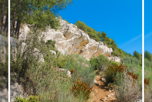
Hiking on the Nerthes Trail at the Massif du Gros Cerveau
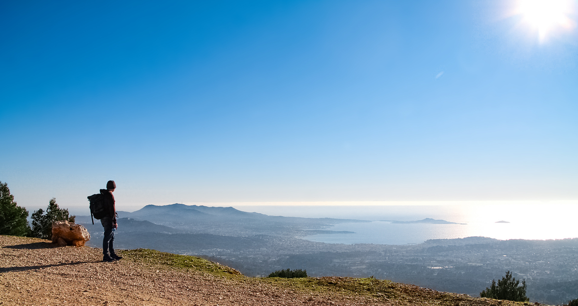
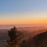
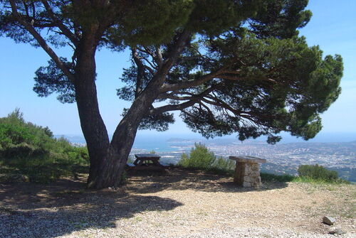
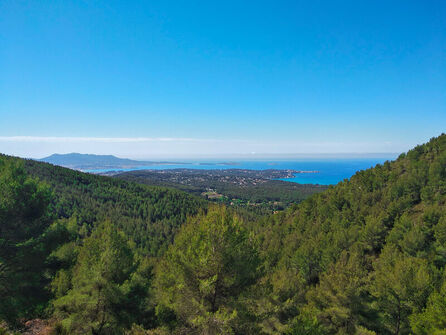
Beautiful family hike on the heights of Ollioules and Sanary, offering magnificent views of the bays of Bandol, Sanary and the Sainte-Baume mountain range. At the top, you can observe the work of the Gros Cerveau point.
Description
Departure/Arrival: Chemin de Sainte Trinide, parking at the foot of the Garden of Olives, near the Animal and Botanical Park ZOA.
BUILDINGS : blue
To reach the start of the hike, from Sanary in the direction of Bandol, follow the indications "Jardin exotique". Pass under the highway bridge, after the barrier, park on the side of the road at the Conservatoire du Jardin des oliviers.
At the beginning of the itinerary, take the road "Chemin de Sainte-Trinide", direction North-East, following the blue markings.
At the intersection, continue straight ahead on the road to "la Piole Paul Venel". A few hundred meters further on, be careful: the circuit leaves the asphalt. Turn left onto a path lined with cranks.
There is an information panel at the entrance. Follow this path and pass in front of an old lime kiln. Continue straight ahead.
At the next intersection, take the path on the left and continue uphill to the Gros Cerveau road.
Cross the road and take the trail on the left through the firewall towards the west. Continue on the paved road.
Stay alert! In a right turn, take the trail going down on your left. At this point, following the asphalt road, you can go back and forth for a few meters to discover the work of the Pointe du Gros Cerveau and the panorama.
At the bottom of this path, at the intersection with the track, turn left for a few meters and in the right hairpin, at the level of the cistern, take the path on the left. Go down.
At the end of this descent, turn right and after 150 m, take the path on your left. Follow it to the next intersection, then take the trail on the right that will bring you back to the starting point of the loop.
At this point, take the starting route in the opposite direction, which takes you back to the parking lot.
Environments
-
 Close to GR footpath
Rates
Free access.
Good deals
🥾 Precautions to take: Make sure to bring enough water and extra food. 📱 Equip yourself with good walking shoes and a fully charged phone. 🆘 In case of emergency, dial 112.
⚠️ Every summer, the Var Prefecture regulates the access, circulation, and parking on certain roads leading to the 9 forested areas in the Var region. This system informs walkers about access possibilities to the forest areas and ongoing work in the forests.
In summer, always check the Var forest access map before going on any hike.
➡️ https://www.risque-prevention-incendie.fr/var/index.html
Itinerary
-
 Distance
8km
Distance
8km
-
 Type of itinerary
LOOP
Type of itinerary
LOOP
-
 Elevation gain
300m
Elevation gain
300m
-
 Elevation drop
300m
Elevation drop
300m
-
 Duration
04h00
Duration
04h00
-
 Marked trail
Yes
Marked trail
Yes
-
 Nature of the land
Non-groomed itinerary,
Stone,
Ground,
Grit,
Not suitable for strollers
Nature of the land
Non-groomed itinerary,
Stone,
Ground,
Grit,
Not suitable for strollers
Opening time
All year round.
Attention, as every year during the summer, from mid-June to the end of September, the Var Prefecture regulates access, circulation, and parking on certain roads leading to the 9 forested areas in the Var region.
🚫 The Gros Cerveau massif is inaccessible by car during this period. Information is updated daily during the summer period: https://www.risque-prevention-incendie.fr/var/index.html.
Location

Pets
Pets allowed : Yes
Themes
-
Tips : 🥾 Precautions to take: Make sure to bring enough water and extra food. 📱 Equip yourself with good walking shoes and a fully charged phone. 🆘 In case of emergency, dial 112.
⚠️ Every summer, the Var Prefecture regulates the access, circulation, and parking on certain roads leading to the 9 forested areas in the Var region. This system informs walkers about access possibilities to the forest areas and ongoing work in the forests.
In summer, always check the Var forest access map before going on any hike.
➡️ https://www.risque-prevention-incendie.fr/var/index.html


-
Ollioules
 patrimoine naturel Open
Massif du Gros Cerveau
- Mountain
- Forest
-
Sanary-sur-Mer
patrimoine naturel Open
"Le Gros Cerveau" forest massif
- Viewpoint
- Natural wonder
- Forest
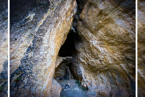
- Cave
-
Sanary-sur-Mer
randonnee Open
Walks and nature in the Gros Cerveau...
-
Sanary-sur-Mer
patrimoine naturel Open
The Garou Cave
- Cave
-
Sanary-sur-Mer
patrimoine naturel Open
The Curade Rock
- Natural wonder