Back to
randonnee
Back to
randonnee
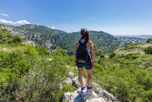
Walks and nature in the Gros Cerveau mountain


The Gros Cerveau... This rocky ridge bordering the plain of Ollioules-Sanary has always excited the imagination.
Description
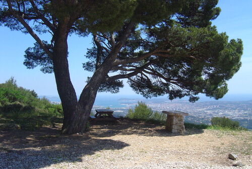
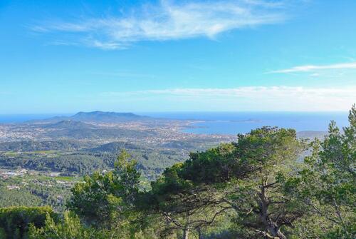
The Gros Cerveau is a limestone mountain which rises to 443 m, dominating the bays of Sanary and Bandol. It stretches over the municipalities of Sanary sur mer, Ollioules, Castellet, Beausset and Evenos.
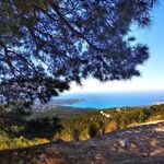
On the east side, the Gros Cerveau offers a magnificent view of Toulon, the harbor on the Seyne sur mer.
The view extends towards Saint-Mandrier, the Giens peninsula and the island of Porquerolles.
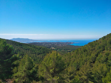
On the west side, we discover the bays of Sanary, Bandol, La Ciotat ...
North side, the chain of Sainte-Baume.
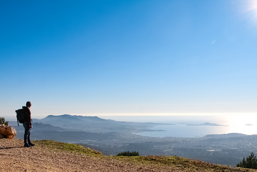
The visitor to the summit is rewarded with a magnificent view and breathtaking scenery.
Almost 20 km of trails (marked in red and blue), including a long-distance hiking trail (GR51), offer walkers a multitude of routes.
At the western end of the massif, the remains of an exceptional architectural heritage remain. This military structure built at the end of the 19th century has a spectacular view of the bay of Sanary - Bandol.
The Gros Cerveau massif is inaccessible by car, from June 15 to September 30
Smoking is prohibited in forest areas.
Caution to be taken: remember to bring sufficient water and extra food.
Equip yourself with good walking shoes.
Additional welcome
Precaution to be taken :
Remember to bring water and food in sufficient quantities.
Make sure you have good walking shoes and a charged phone.
In case of an emergency call 112.
Caution :
As every year during the summer, from 19 June to 20 September, the Var Prefecture regulates access, traffic and parking on certain roads serving the 9 Var forest areas. This system informs walkers about the possibilities of access to the forest areas and the level of danger of forest fires.
Information by telephone on 04 94 96 43 43 or on the following link:
www.var.gouv.fr/acces-aux-massifs-forestiers-du-var-a2898.htm
Environments
-
 Close to GR footpath
Rates
Free access.
Itinerary
-
 Type of itinerary
LOOP
Type of itinerary
LOOP
-
 Marked trail
Yes
Marked trail
Yes
-
 Marking details
2 hiking trails to discover:
The Red Circuit:
From valleys to balconies through the fort of Gros Cerveau and the fort of La Pointe.
Distance: 13 km, positive altitude difference: 700 m. Duration: from 6h.
Departure from Chemin Sainte Trinide, parking in front of the Jardin des Oliviers, near the Zoa Animal Park.
The Blue Circuit:
Between Drailles and crests. Family walk.
Distance: 8 km, positive altitude difference: 300m. Duration: 4 hours.
Departure from Chemin Sainte Trinide, parking in front of the Jardin des Oliviers, near the Zoa Animal Park.
Marking details
2 hiking trails to discover:
The Red Circuit:
From valleys to balconies through the fort of Gros Cerveau and the fort of La Pointe.
Distance: 13 km, positive altitude difference: 700 m. Duration: from 6h.
Departure from Chemin Sainte Trinide, parking in front of the Jardin des Oliviers, near the Zoa Animal Park.
The Blue Circuit:
Between Drailles and crests. Family walk.
Distance: 8 km, positive altitude difference: 300m. Duration: 4 hours.
Departure from Chemin Sainte Trinide, parking in front of the Jardin des Oliviers, near the Zoa Animal Park.
-
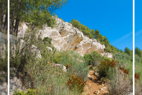
Tricky passage
Stony ascent, steep and stony raidillon, delicate section (steep and gullied descent) will be on the Belvedere trail.
-
 Nature of the land
Rock,
Stone,
Ground,
Not suitable for strollers
Nature of the land
Rock,
Stone,
Ground,
Not suitable for strollers
Opening time
All year round.
Location

Pets
Pets allowed : Yes


-
Type of itinerary
LOOP
-
Marked trail
Yes
-
Marking details
2 hiking trails to discover:
The Red Circuit:
From valleys to balconies through the fort of Gros Cerveau and the fort of La Pointe.
Distance: 13 km, positive altitude difference: 700 m. Duration: from 6h.
Departure from Chemin Sainte Trinide, parking in front of the Jardin des Oliviers, near the Zoa Animal Park.
The Blue Circuit:
Between Drailles and crests. Family walk.
Distance: 8 km, positive altitude difference: 300m. Duration: 4 hours.
Departure from Chemin Sainte Trinide, parking in front of the Jardin des Oliviers, near the Zoa Animal Park.
-
 Tricky passage
Stony ascent, steep and stony raidillon, delicate section (steep and gullied descent) will be on the Belvedere trail.
Tricky passage
Stony ascent, steep and stony raidillon, delicate section (steep and gullied descent) will be on the Belvedere trail.


-
Ollioules
 patrimoine naturel Open
Massif du Gros Cerveau
- Mountain
- Forest
-
Sanary-sur-Mer
patrimoine naturel Open
"Le Gros Cerveau" forest massif
- Viewpoint
- Natural wonder
- Forest
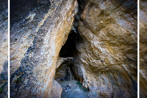
- Cave
-
Sanary-sur-Mer
randonnee Open
Walks and nature in the Gros Cerveau...
-
Sanary-sur-Mer
randonnee Open
Hiking on the Nerthes Trail at the Ma...
- Distance 8km
- Duration 04h00
- Elevation gain 300m
- Elevation drop 300m
-
Sanary-sur-Mer
randonnee Open
Hiking on the Belvedere trail at the...
- Distance 13km
- Duration 06h00
- Elevation gain 700m
- Elevation drop 700m
-
Sanary-sur-Mer
patrimoine naturel Open
The Garou Cave
- Cave
-
Sanary-sur-Mer
patrimoine naturel Open
The Curade Rock
- Natural wonder